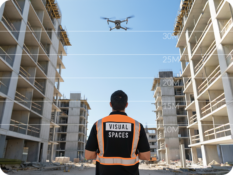
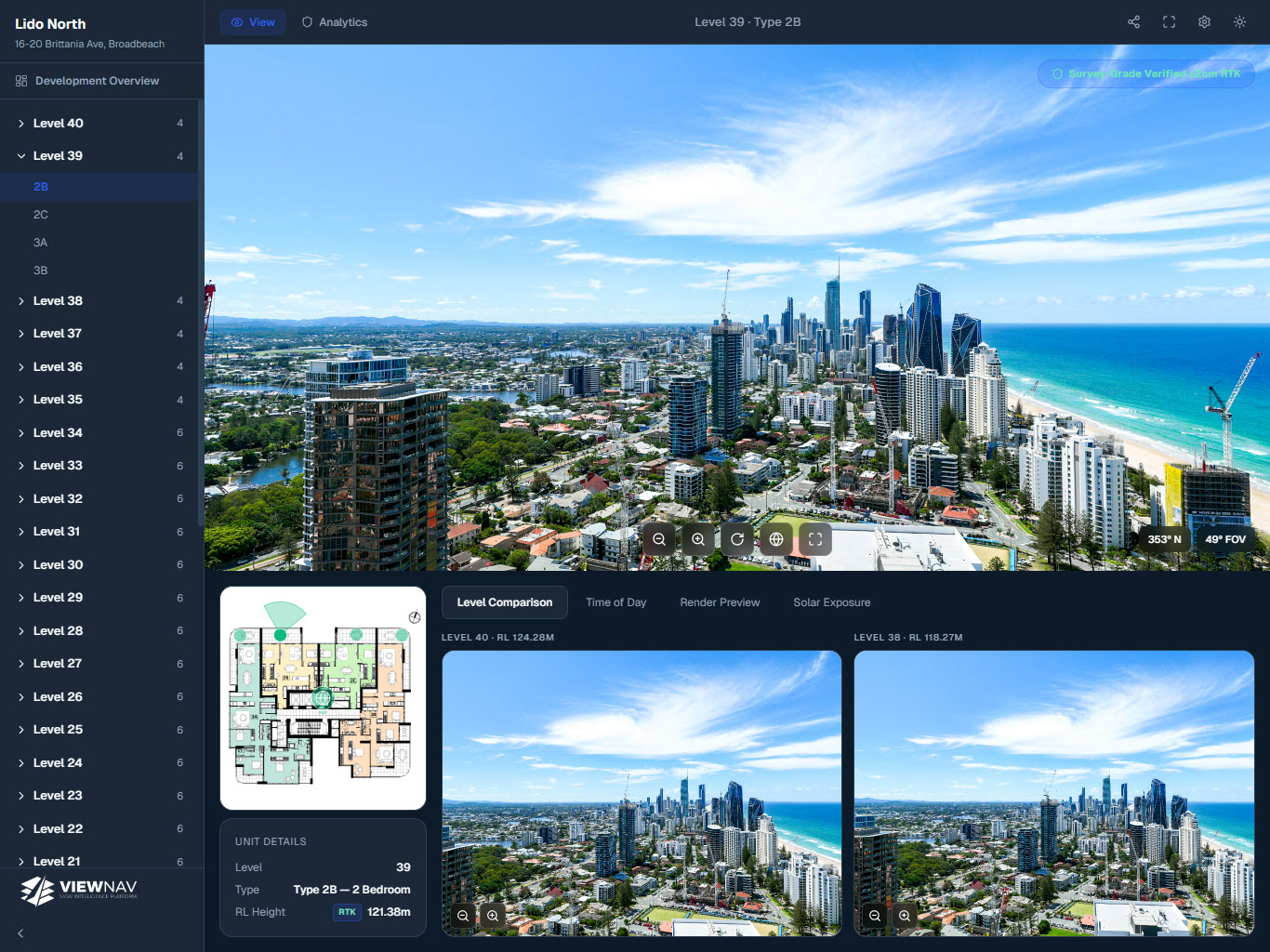
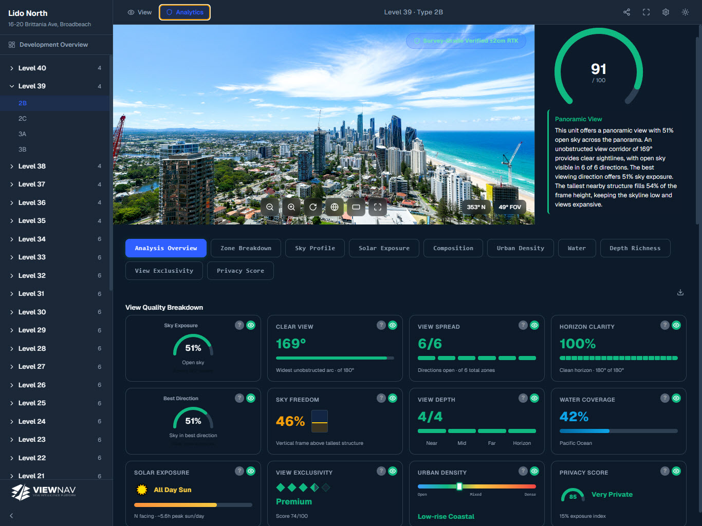
ViewNav delivers verified, floor-level view data for every unit in your development — as an interactive sales tool, an analytics platform, or both.

Every ViewNav project is built on three components — verified panoramic capture, an interactive viewer for sales teams, and AI-powered analytics for developers and agents. Use one, two, or all three. Capture can be supplied by you or handled by Visual Spaces for SEQ projects.
The data standard that powers the platform. Supply survey-grade panoramic imagery with EXIF metadata and we build your ViewNav project from it. RTK capture delivers the highest accuracy — available for SEQ projects through Visual Spaces.
An interactive, embeddable viewer that lets buyers and sales teams explore every floor's view from a single shareable URL.
AI-powered analytics that quantify every dimension of view quality — giving developers and agents verified data to price, present, and defend view premiums.
Share your development address, level count, and floor plan. Supply your own survey-grade panoramic imagery, or we capture it for you (SEQ) — we'll scope accordingly and provide a fixed-price proposal.
We process your imagery, configure the viewer and analytics for your development, and verify every floor level against the capture data.
Your ViewNav project is live — a shareable URL with interactive viewer, AI analytics, and embed code ready for your campaign site or sales suite.
ViewNav works with any survey-grade panoramic imagery that meets the capture spec — floor-level, correct RL elevation, EXIF bearing, altitude and GPS embedded per image. GPS-captured imagery is fully supported. For the highest positional accuracy, RTK capture locks every panorama to a verified real-world coordinate at ±2cm — available for SEQ projects through Visual Spaces.

A shareable, embeddable interactive viewer that puts buyers inside the real captured view — at the precise eye-level elevation of each unit. 80% of our clients add the viewer to their drone capture project.

View AI is the intelligence layer that sits on top of your captured panoramas. It runs every unit through 10 analytics dimensions — from sky exposure and solar access to urban density and privacy — producing a VQI score that turns subjective view claims into verified, quantified data.


“The level of detail in the view data gave our team something we'd never had before — a number we could stand behind when pricing upper floors.”
“Having the viewer embedded in our campaign site meant buyers could see exactly what they were buying. It cut a lot of the back-and-forth during inspections.”
“We've embedded the viewer into three campaign sites now. Clients ask for it by name — they know what ViewNav is before we even bring it up.”
View AI is added to any ViewNav project as a flat one-time fee — no subscription, no lock-in. Tell us about your development and we'll include it in your proposal.
Fixed-price · No lock-in · Response within 1 business day